I began learning GIS in 2010, as part of a summer fellowship studying possible spatial relationships between alcohol availability and drunk driving. Since that time, I have taken 12 semester hours of courses covering introductory and advanced spatial analysis, along with GIS programming with Python. Working in GIS has been a daily part of my responsibilities since 2012 and was a major focus of my graduate research, where I developed an analysis model to track changes in channel form within in the lower Green River. The model included estimating the magnitude of uncertainty for in my channel change analysis.
As a GIS analyst, I am experienced in processing raw data, converting data for analysis in ArcGIS, analyzing data, creating models to speed workflow for common tasks, and cartography to create accessible maps for reports and presentations. Those services complement my strong field work abilities; I am equally comfortable collecting data in the field or processing it in the office. I am versed in technical writing and the production of suitable graphics. This suite of skills allows me to contribute productively to a wide range of positions and take on whatever is needed in the context of a project.
![Study_Area-[Converted].jpg](https://images.squarespace-cdn.com/content/v1/549ee800e4b0504d1e9cf6b1/1552434189748-2DU0IHM3ZD3WLNDO0KXK/Study_Area-%5BConverted%5D.jpg)
In my current work as a GIS Specialist, I’ve added expertise with database work, especially using ESRI’s Spatial Database Engine (SDE) to provide a centralized data repository for users. In addition, I also work extensively with ArcGIS Online and ArcGIS Enterprise to share data and information, and their associated apps, Survey123, QuickCapture, and Collector.
As a consultant, I completed a spatial analysis of tropical river systems, assessing their potential for channel change. As part of mine remediation work, a larger river is being diverted into the channel of a smaller river. I assessed historical channel change, as well as changes in slope, to better estimate possible future conditions. I conducted a detailed spatial analysis of available aerial imagery and elevation data in order to extract multiple variables over two decades that track the level of channel activity in multiple dimensions. In 2018, I processed multiple bathymetric surveys, correcting the raw data and creating multiple raster datasets as the final product.
The web pages below served as reports for lab exercises I did as part of a graduate Advanced GIS course at Utah State in Spring 2015. I've kept the pages to show the range of skills I’ve acquired. If you are interested in learning more about my GIS work and skills, please contact me.

Lab 1: ArcGIS refresher and intro to WebGIS

Lab 4: Proposed Campground
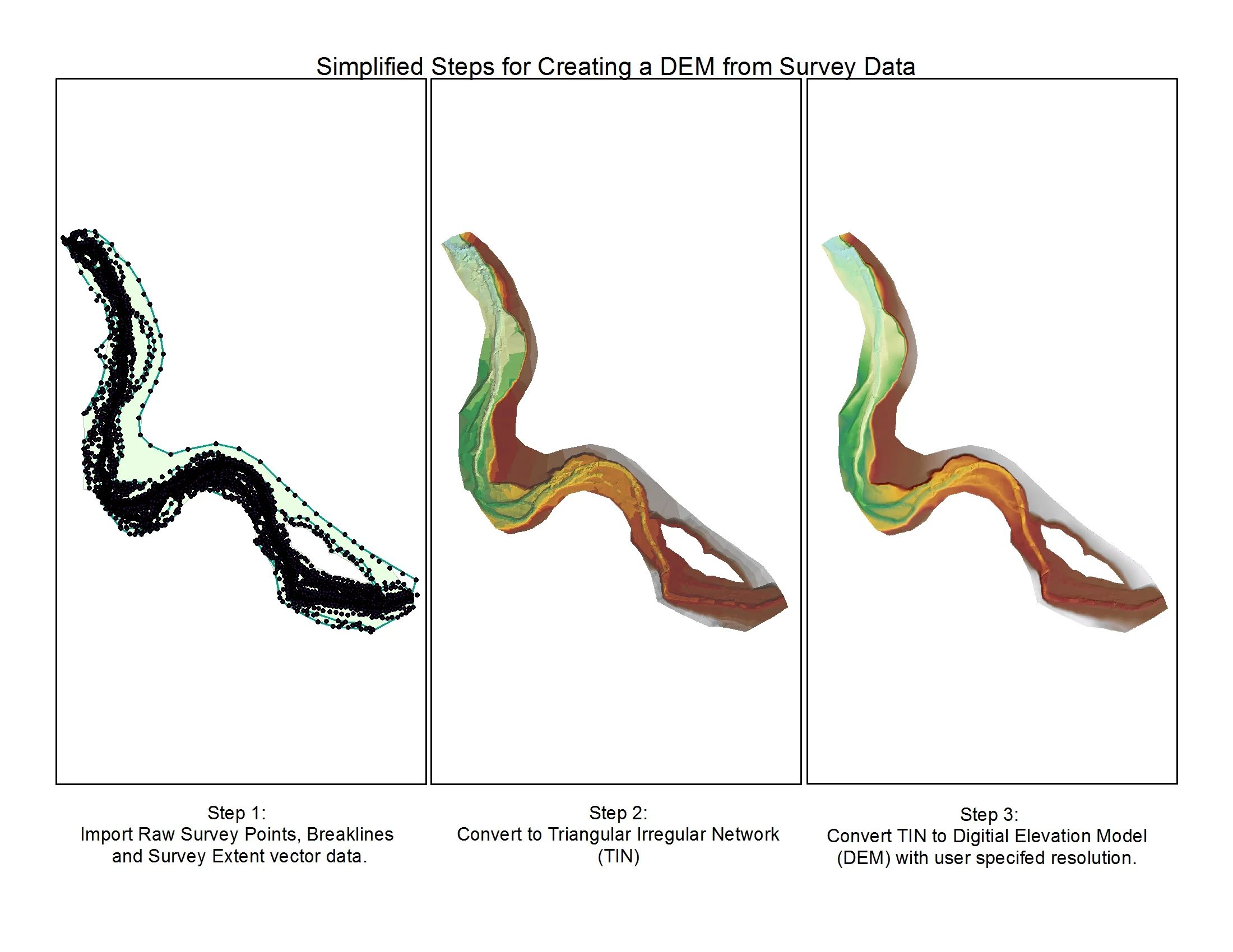
Lab 7: Creating DEMs

Lab 2: Coordinate Data, Projections and Transformations

Lab 5: Oil Spill Response

Lab 8: Morphometric Analysis

Lab 3: Reproducing a geologic map

Lab 6: Reproducing DEMs

Lab 9: Georeferencing